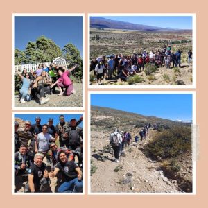
Trail located 3 kilometers west of the city of Malargüe, in the foothills of the Andes. It is 5 km long and takes approximately 2 hours. With an ascent of 133 meters along the route. Enjoying its tranquility, flora, fauna and the pure air that this natural space provides makes it suitable for any type of hiker. This site can be accessed throughout the year, as long as weather conditions allow. Its use is free and open to the public. It is recommended to be accompanied by a guide, but it is not a mandatory condition. There are no toilet and first aid services on this route, so it is recommended to carry a mobile phone since there is telephone coverage in case of any eventuality. Another of the climatic characteristics to take into account is the wide thermal amplitude, both in summer and winter.
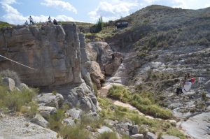
It is an area that stands out for the important exposure of rock outcrops of marine origin where fossil remains from the Jurassic and Cretaceous are found, deposited thanks to the ingress of the Pacific Ocean on the continent
Visit us on Instagram
Small-co Trail Trail located 2 kilometers west of the city of Malargüe, on the road to Castillos de Pincheira (Paso Carqueque), in the foothills of the Andes. It is 17 km long and takes approximately 4 hours. With an ascent of 285 meters along the route. Enjoying its tranquility, flora, fauna and the pure air that this natural space provides makes it suitable for any type of hiker. This site can be accessed throughout the year, as long as weather conditions allow. Its use is free and open to the public. It is recommended to be accompanied by a guide, but it is not mandatory. There are no toilet and first aid services on this route, so it is recommended to carry a mobile phone since there is telephone coverage in case of any eventuality. Another of the climatic characteristics to take into account is the wide thermal amplitude, both in summer and winter.
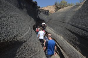
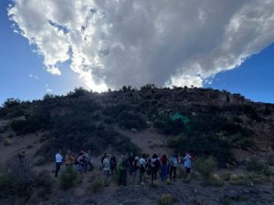
Few volcanoes in the world allow you to visit them from the inside. The Malacara volcano is one of those few.
It is a trek that allows us to enter the volcano through its gullies and from there understand its origin and evolution.
The trek is guided, has a medium level of difficulty and lasts approximately 2 hours and 30 minutes. During the tour you have to climb iron stairs placed to pass large stones. The walk to the viewpoint is about 400m long and has a slope of 45°, which also means an effort.
 ,
,
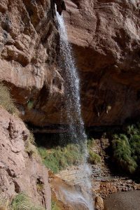
Self-guided trail of approximately 1 hour and 30 minutes, of low difficulty. Favored by being at the highest part of the Chihuido slope, we will observe during the tour the wonderful panoramic views that the slope offers, discovering along the way enchanted viewpoints, crystal-clear waterfalls, stone gullies marked by the passage of time and a large number of marine fossils. Ideal for those who enjoy walking in contact with nature, bird watching, flora and fauna of the place.
GEOLOGY- PALEONTOLOGY- ARCHAEOLOGY- HISTORY AND REGIONAL CULTURE.
40-minute and 1.30-hour trails.
They are guided and the difficulty is 0.
Llano Blanco Geopark Instagram
Archaeological site with rock engravings, Agua Bota, is part of the rock art registry of southern Mendoza with more than 96 sites with rock art.
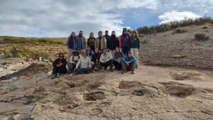
Cretaceous Municipal Park Dinosaur Footprints: A journey back in time to millions of years ago. As you walk through the park, visitors will be able to observe the footprints made by dinosaurs, which have been preserved in the rocks. Each footprint represents an indication of the life that once populated these lands.
Guided trekking
Cretaceous Municipal Park Dinosaur Footprints